 After a buffet breakfast that is not nearly as good as yesterday's, we head about 16 miles north and west to the isolated town of Wiseman. This town was founded in 1908 after gold was found in the river near by in 1907.
 The gold petered out rather quickly, but some hardy souls continued to live in the town. It has been continuously occupied since and is the most northerly settlement that can make that claim.
 We spend about two hours visiting with a man, age 52, who was raised in an area west of the town and moved with his parents to Wiseman as a child. He raised his family here. He went to Anchorage for a semester of college, but did not like the urban lifestyle so came home. He has been in Wiseman ever since. He is a true self educated man and a fountain of information on this part of the world! He told us about his family’s subsistence lifestyle: how they grow or gather their food, the adaptions he makes for the short growing season and how they cook, light and heat the house. He uses a combination of solar power, wind, wood and propane. He hunts and traps and serves as a weather station and animal monitor for the Parks and Game service.
He has been in Wiseman ever since. He is a true self educated man and a fountain of information on this part of the world! He told us about his family’s subsistence lifestyle: how they grow or gather their food, the adaptions he makes for the short growing season and how they cook, light and heat the house. He uses a combination of solar power, wind, wood and propane. He hunts and traps and serves as a weather station and animal monitor for the Parks and Game service. He then took us around the village and showed us the small house that served as a home school for his children, the chapel, the post office, that was active from 1910 to 1956, and several other homes in the town.
 Since the Dalton Highway was built some adventurous souls are finding their way to Wiseman for R and R during the summer and, of course, people like us who are just interested.
that was active from 1910 to 1956, and several other homes in the town.Since the Dalton Highway was built some adventurous souls are finding their way to Wiseman for R and R during the summer and, of course, people like us who are just interested. From there we go back to Coldfoot to the National Park Information Center and then head south on towards Fairbanks. We are driving through a high river valley and the fall colors are outstanding. We pass through Prospect Creek where the coldest temperature ever reported in the US occurred, -79.8F. Jack, our guide earlier in Wiseman, said he does not get out if it is below -50F...bad things happen to the human body and to metal. Steel springs and such can shatter like glass at those temperatures.
and then head south on towards Fairbanks. We are driving through a high river valley and the fall colors are outstanding. We pass through Prospect Creek where the coldest temperature ever reported in the US occurred, -79.8F. Jack, our guide earlier in Wiseman, said he does not get out if it is below -50F...bad things happen to the human body and to metal. Steel springs and such can shatter like glass at those temperatures.We cross the Arctic Circle, marked with a sign, and stop for pictures. At Gobbler's Knob we run out of the Brooks Range and are now in a high meadow valley.
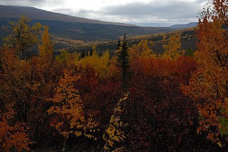
 The fall colors continue to be outstanding.
 About 2PM we stop for lunch at Finger Mountain, an interesting granite outcropping.There is archaeological evidence that it was used by hunters as much as 10,000 years ago. Probably as a lookout point for animals in the valley below.
 Then we head to the Yukon River where we stop again for pictures and ice cream.
 The river is much wider than it was in Dawson City some 800 plus miles upstream.
At Gobbler's Knob we run out of the Brooks Range and are now in a high meadow valley.The fall colors continue to be outstanding.About 2PM we stop for lunch at Finger Mountain, an interesting granite outcropping.There is archaeological evidence that it was used by hunters as much as 10,000 years ago. Probably as a lookout point for animals in the valley below.Then we head to the Yukon River where we stop again for pictures and ice cream.The river is much wider than it was in Dawson City some 800 plus miles upstream.After crossing the Yukon River, we are in rolling, forested land with the pipeline beside us the rest of the way. It is a pleasant drive and we talk among ourselves. We are very lucky with the small group and we get along very well. Hamos is an asset. He is about 30 and has taken five months off to travel around the world. So far he has spent all his time in the western US, but is planning to go to Japan next. He is a computer guru from Austria and his English is excellent. Our other passenger is about our age and had planned to retire this year. In fact, this was to be her retirement trip but the economy changed her plans and she will return to work. She has a small motor home that she travels in by herself. She is from San Diego, CA.
It is a pleasant drive and we talk among ourselves. We are very lucky with the small group and we get along very well. Hamos is an asset. He is about 30 and has taken five months off to travel around the world. So far he has spent all his time in the western US, but is planning to go to Japan next. He is a computer guru from Austria and his English is excellent. Our other passenger is about our age and had planned to retire this year. In fact, this was to be her retirement trip but the economy changed her plans and she will return to work. She has a small motor home that she travels in by herself. She is from San Diego, CA.We get back to Fairbanks about 8:30PM. We are weary but very glad that we did this trip. It was loads of fun and very enlightening. We kept saying we are done with expedition type trips, but they just keep calling to us!
We head straight to Chili's for some food and then to the rig and bed!
and bed!


 which are breaks in the top few feet of the ground and pingos, pyramid shaped upheavals in the suface. Both are formations on the surface caused by the action of the permafrost underneath. We see many polygons and a few pingos and lots of small lakes and ponds even though this is considered a desert.
  Of course, they eventually see us and get up.
 It turns out to be four...one is a calf. They look like a really shaggy small buffalo, and the calves are one of the bear's favorite meals. We see several more groups for a total of 20 as we head up into the Brooks foothills. According to the biologists that watch the muskox there are only about 70 left since the young are a favorite food of the bears in this area.
  with some fledglings, Canadian geese, greater white fronted geese and a Hawk Owl that zigged when it should have zagged. That is a shame since it is really pretty bird. We also see cariboo and calves. This is their summer calving area.
 and of course the pipeline is marching beside the road most of the way.
 It goes underground some, but we can still see the green grass on the surface above its route since that ground is warmer than the rest of the area.
  to use for their camps.
 We hike in with lunch in hand and find some rocks to sit on. It is special because there are Dall sheep grazing right in front of us!
  Never mind it is in the 40'sF and a wind is blowing...we are all well layered and having an awsome adventure!
 We drive over the "Ice Cut" that the Ice Road Truckers talk about. It is "famous" because it has a guard rail on the outside, straight down edge. The rail is pretty dinged up too! Rob says you know it is a bad steep curve because there is a guard rail!
  Galbriath Lake
 and Rainbow Glacier. This is a fabulous park. It is hike in only, but the entrance is a wonderful place to stop...to bad we don’t have the motorhome so we can stay awhile!
  As it turns out, a hunter just flew one in from the interior with his moose kill. He and his buddies are up here in their two planes hunting and using the airport field as their base camp. We spend some time talking to him and the guys help him get his 1,000 lbs. of moose packed away. I must say the head and antlers are quite impressive.
  and head into the glacial valley of Atigun Pass, the infamous pass through the Brooks Range on the Haul Road...made famous on Ice Road Truckers! It is almost straight up
 and down
 ...Rob says the builders of the road felt switch back were inefficient! It had rained and snowed the day before and the truckers were using chains this morning, but it is warmer now with some blue sky and sunshine so the road is now a sea of mud about 8 inches deep. The pass is beautiful. Near the top a trucker radios Rob that there are sheep near the chain up area so we pull off for a look
 and for Rob to get up his courage to go over the pass...he has been dreading it all day...he didn’t want to have to roll around in the muck to chain up!
 So off we go. It is a neat ride and we have no trouble until we are going down the south side and encounter a truck stuck in the mud....it gets tense in the van as Rob weaves through the stopped traffic trying not to slow down enough to sink in the mud himself! The van slips and slides, but we get through. What an awful mess and to think the truckers put up with this and worse all the time! According to the radio traffic the stalled trucker will have to be towed out of the mud. There is constant chatter on the CB between the drivers, including Rob, on road conditions and just friendly banter at times.
 To make it perfect, we have left all the clouds behind and are in that perfect late afternoon light that has such a glow.
 It is a beautiful drive
 on into Coldfoot,
 our stop for the night. We have enjoyed the first 240 miles of the Haul Road even if it has taken 12 hours to cover.
 The buildings are the same as in Deadhouse, just dirtier, mainly because the whole town is, simply put, a sea of mud!
 It is about 8:30PM when we get there. We get settled into our rooms and meet in the café for some dinner. It is an interesting group..rough and ready truckers with their colorful language, a few independent types like us and maybe 60 cruise passengers on two Holland American tour buses! The cruise ladies are tiptoeing through the mud in their leather high heel shoes and matching colorful ski wear! Some of the cruise lines now offer bus tours to Deadhorse.
 and we are off! No baggage check, no security, no X-ray line!The flight is two hours and about ten minutes in a 9 passenger, plus pilot, Piper Navajo and is uneventful. There are only 4 passengers plus the pilot and the 4 of us will be doing the drive back together in the 15 passenger van that is set up for 10. That will be nice as there will be room to move around in the van.
 There are thousands of tundra ponds on the North Slope; very pretty from the air.
 You must remove your shoes at the door. Everyone is walking around in sock feet or dedicated indoor shoes. The facilities are dorm style with men's and women's baths and toilets down the hall. Actually, ours are down the hall and up stairs one flight. As an added attraction, we have a view of "The Haul Road" and the Brooks Range from our room. We are told the rooms don't have keys. “Everyone has a good job and doesn't want your old camera or laptop!” Lunch, huge grilled hamburgers, is at noon and we get out and walk around a bit after that taking pictures of the road signs,
 the equipment and the buildings around our “Camp”.

 and go for the guided tour of some of the Prudhoe oil field and our visit to the Arctic Ocean shore.
 The wind is now blowing a gale and it is trying to snow mixed with light rain and sleet! Our stop at the ocean is at East Dock which never saw any ship traffic....they built the dock, but no one checked on the water depth before hand. At the end of the dock it is only three or four feet deep! They now have a West Dock that goes out about a mile and can handle cargo ships. Back at the camp, warm and dry, we have an Alaskan Mexican dinner which is not to bad. As we leave the dinning room, we see the sun is out and there is the beginning of a great sun set. So all four of us gear up again and head outside for some pictures.
 After that we fall into bed and sleep the sleep of the dead! So far, we are glad we made this side trip. It is very interesting to see it all.